Did you know that Ballina is on an Island?
Ballina is situated in the Northern Rivers, just one hour from the Gold Coast or two hours from Brisbane. As Byron Bay becomes too busy for some people, the delights of Ballina are being discovered. It has great surfing, cycling, fishing as well as safe river or swimming at Shaws Bay.
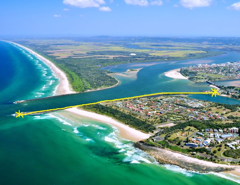
When you arrive at Ballina it’s easy not to notice but, the town is in fact surrounded by water, separated from the mainland by North Creek and the Richmond River. So it is an island!
When you approach the centre of Ballina from the south, you will cross over the Fisheries Creek bridge onto Ballina Island. You leave the island by crossing over North Creek at Missingham Bridge. You will often hear locals referring to the Island, meaning the Town Centre
South Ballina is across the river and can be accessed either from the highway at Wardell Bridge or from West Ballina by using the Burns Point Ferry. http://www.ballina.nsw.gov.au
Circular Drive Route 30.
If you are looking for an interesting circular coastal drive. Take the short 10 minute car ferry across the Richmond River and explore South Ballina. This is part of the Route 30 Coastal Tourist Drive. It can also make an alternative route for you when driving south.
Download a copy of the map of the drive at http://www.discoverballina.com.au
Alstonville is a great central point to base yourself and explore both the coast or hinterland by car.
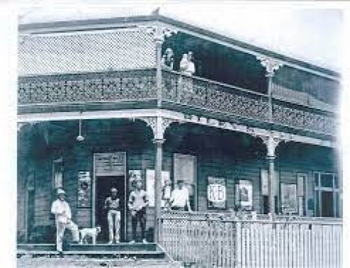
Australia’s Smallest Post Office
Ballina is probably better known for its Big Prawn but did you know the village of Empire Vale across the Richmond River is ‘home of Australia’s smallest working Post Office’?
http://www.uniquelynorthcoast.wordpress.com
At one time, Australia had many small post offices, most of which have been closed due to economic challenges. The Post Office for small communities, was and still is, an important hub for socialising and networking.
In the Northern Rivers, there was a rivalry between the districts of Rock Valley (near Nimbin) and Empire Vale (South Ballina), only an hour’s drive apart, as to which was Australia’s smallest post office. In 1995 Australia Post gave the award to Rock Valley but in 2012 Rock Valley’s post office suddenly burned down. It was rebuilt but with an enlarged verandah and so Empire Vale as the second smallest was promoted to the prestigious recognition as Australia’s smallest licensed post office!
Burn’s Point Ferry
To reach Empire Vale involves taking the ferry across the Richmond River that links West Ballina to South Ballina. The car ferry runs regularly back and forth on underwater cables from early morning to almost midnight. It only takes a few minutes but can carry cars, trailers, bikes and foot passengers and is a quick, vital link to the town centre for the residents of South Ballina.
On the short trip across, take time to get out of your car and try to spot the cormorants drying their wings in the mangroves. You may also see the Richmond River Sailing Club sailing nearby on their regular Sunday races.
Take some bread with you and on arrival you will see a mass of fish who await the ferry, ready to be fed.
South Ballina Beach
From the ferry you can turn left or right. Left takes you to the South Wall where you can fish or walk out to the mouth of the river and the Pacific Ocean. Hopefully you will see dolphins playing in the swell or during winter the Humpback Whales are regular visitors.
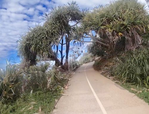
Looking south you will see the extensive 30 km windswept South Ballina Beach which extends all the way to Evans Head. The northernmost point of the beach is a known nesting spot for many seabirds. Pedestrian access to the beach is possible from here across the sand dunes.
Alternatively you can turn south from the ferry and drive along the riverbank hugging the eastern side of the Richmond River. On the left are views across the cane and soya fields towards the Pacific Ocean about three kilometres away. It is interesting to see how many of the cane fields are now being replanted with macadamia trees.
Heading along this quiet scenic backwater, it is strange to think that it once used to be the main highway until 1964, when the Wardell Bridge was opened.
Empire Vale
The Post Office appears on the right, a building about the size of a small garden shed set back a few metres from the road. The primary school is across the road.
The district of Empire Vale has gone through a few different names, originally being known as Pimlico South as a counterpart to the village of North Pimlico (today Pimlico) on the west side of the Richmond. In 1895, the name changed to German Creek as a reflection of the number of Germans who had settled there but was later changed again to Empire Vale.
From the River Road you will see signs to Patches Beach which is another pedestrian or 4WD access point through the dunes to this pristine unspoilt beach. It is a popular spot for sea fishing. http://www.beachsafe.org.au
Alternatively if you continue driving along the river bank you will reach the Wardell Bridge and back onto the Pacific Highway. Stop off on your way at delightful Wardell.
Wardell
The village of Wardell is a tiny village set on the edge of the river. It used to be a centre for the cedar getters in the 1850s and then became important with sawmilling and the cane industry. It still has a few historic buildings, a general store, a post office, a pub and a primary school. The pub is set on the edge of the river, ideal for launching your boating, jet ski or fishing.
Wardell is also home of the tasty Wardell Pies. Drop into the Wardell Pie shop and select a pie from the wide choice.
You can then either keep heading South on your travels
or return to Alstonville or Ballina.